Description
Geoinformation service that allows you to evaluate the selected house by the number and distance to nearby infrastructure facilities (metro stations, hospitals, schools, pharmacies, etc.) and get a final weighted estimate showing how convenient and comfortable it will be to live in the house chosen by the user (the so-called geoindex).
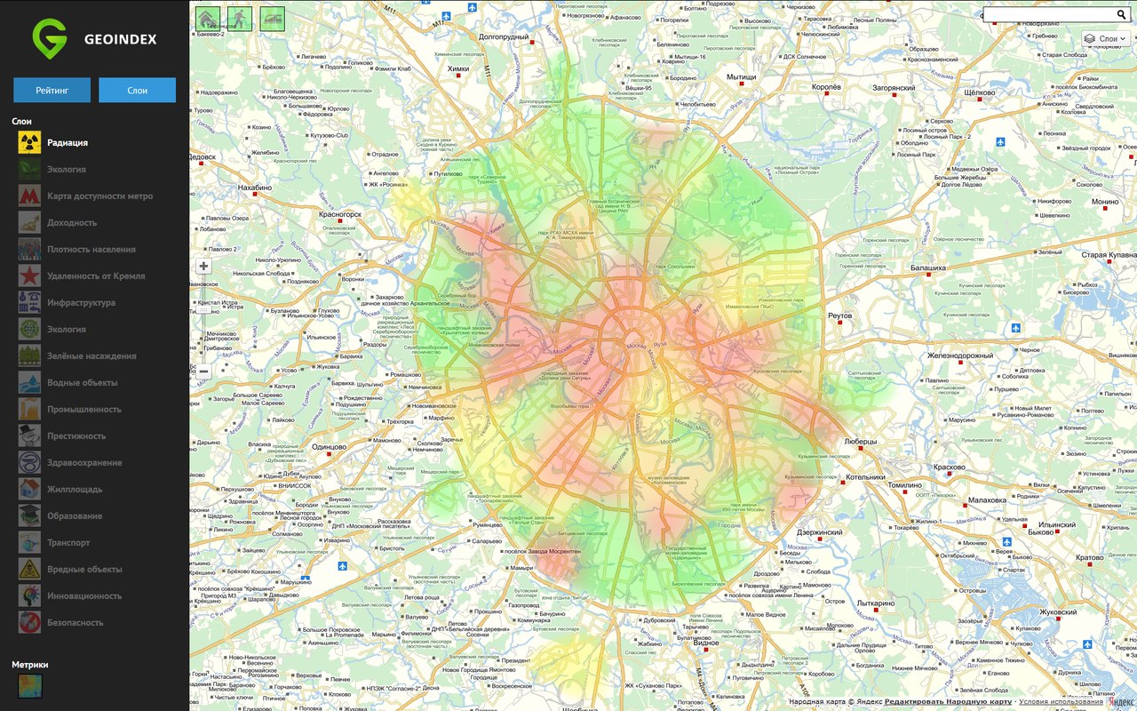
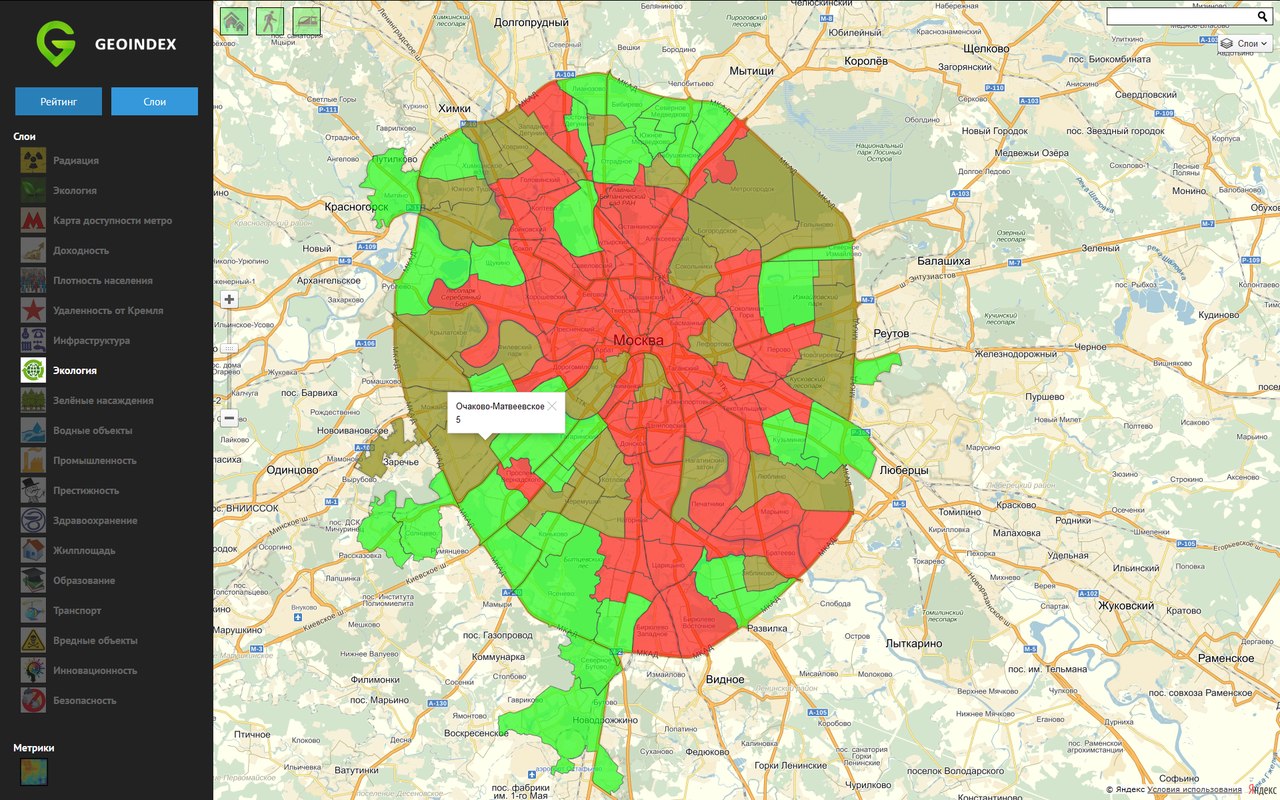
The service also has a layer functionality that allows you to display various information layers on the map for the selected city, which allows you to answer general, but at the same time important questions like: "Which area is the most polluted?" or "Which areas have the most favorable ecology?"
The service also has a layer functionality that allows you to display various information layers on the map for the selected city, which allows you to answer general, but at the same time important questions like: "Which area is the most polluted?" or "Which areas have the most favorable ecology?"
Technology
Programming languages
Python
Technology
Django, YandexMaps API, GoogleMaps API, ES 6, Leaflet, SASS